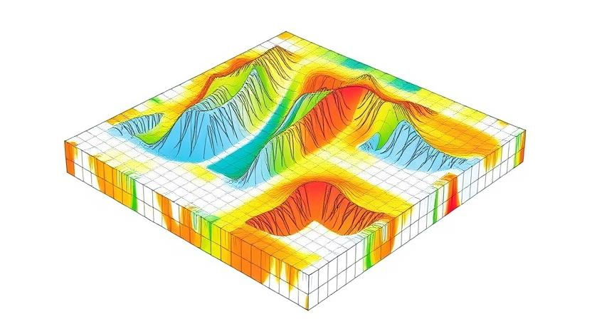
Discover the geology at depth below your 2D geophysical data. Though our inversions use standard, well-established industry practices to project geophysical solutions into 3D, the Metals AI platform makes it easy to invert extremely large or complex datasets and simple to constrain them with any other data sets you provide.
Gravity and magnetic inversion are powerful geophysical techniques used to model the subsurface based on gravity and magnetic field measurements. This methodology provides valuable insights into the distribution of density and magnetization within the Earth’s crust.
Magnetic Inversion
Magnetic inversion is a powerful geophysical technique used in mineral exploration to model subsurface magnetization and detect hidden ore deposits. Magnetic anomalies arise due to variations in the magnetic properties of rocks, often indicating the presence of valuable mineralized bodies such as iron ore, nickel, and copper deposits.
The goal of magnetic inversion is to map the distribution of magnetization by minimizing discrepancies between observed and predicted magnetic anomalies. This process involves solving a complex, non-linear inverse problem to generate accurate 3D subsurface models. These models help geologists and exploration teams identify prospective targets, delineate ore bodies, and refine drilling strategies.
By integrating magnetic inversion with geological data, exploration companies can enhance targeting accuracy, reduce exploration risks, and improve resource estimation.
Looking to optimize your mineral exploration strategy? Contact us to learn how magnetic inversion can enhance your discovery success.
Gravity Inversion
Gravity inversion is a key geophysical technique used in mineral exploration to map subsurface density variations and identify potential ore bodies. This method is based on analyzing gravity anomalies—differences between observed gravity values and theoretical values derived from the Earth’s normal gravity field.
By solving the inverse problem, gravity inversion estimates subsurface density distribution by minimizing the discrepancy between observed and predicted gravity anomalies. This process helps geologists detect dense mineralized zones, such as iron ore, sulfide deposits, and other economically significant resources.
When integrated with geological and geophysical data, gravity inversion enhances target delineation, reduces exploration risks, and supports more efficient drilling decisions.
Looking to improve your mineral exploration success? Contact us to learn how gravity inversion can refine your subsurface models.
Geologically Constrained Inversions
Geologically constrained inversion bridges the gap between geophysics and geology, ensuring that geophysical data aligns with real-world geological structures. Unlike unconstrained inversion, this method preserves the unique identity of geological units while accurately modeling subsurface properties.
The process begins with a geological model, rasterized into a 3D mesh, incorporating key datasets:
- Petrophysical rock properties (e.g., magnetic susceptibility, density) for each geological unit
- Topography data for accurate surface representation
- Geophysical data (e.g., magnetics, gravity) to drive the inversion process
Each unit within the 3D mesh is assigned both physical rock properties and a geological classification (litho-type), maintaining geological integrity while refining the model.
The goal of geologically constrained inversion is to optimize subsurface models using specialized algorithms. This can involve:
- Adjusting physical rock properties while keeping geological structures intact
- Modifying geological unit geometries to improve accuracy
- A combination of both approaches to achieve the best-fit model
By integrating geological constraints, this method delivers more realistic and reliable subsurface interpretations—enhancing exploration, resource assessment, and geotechnical applications.